Ask a question. Get a map, a dataset, a form or an insight. Ready to use.
OrionGIS brings the world's open spatial data, professional mapping, spatial analysis, field collection, dashboards and AI into one connected platform. Simple enough for beginners, powerful enough for GIS professionals.
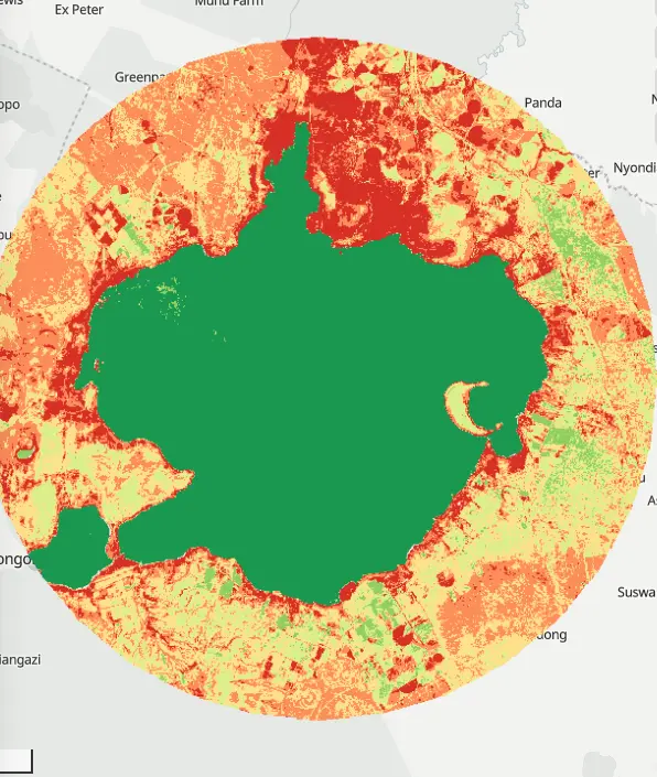
An unsupervised land-cover classification of Lake Naivasha and a 12 km ring around it, built from 22 cloud-filtered Sentinel-2 scenes from January–March 2024 at 20 m cells.
Trusted by organizations in government, education, health, utilities and consulting


Start with the world's GIS data — not an empty map.
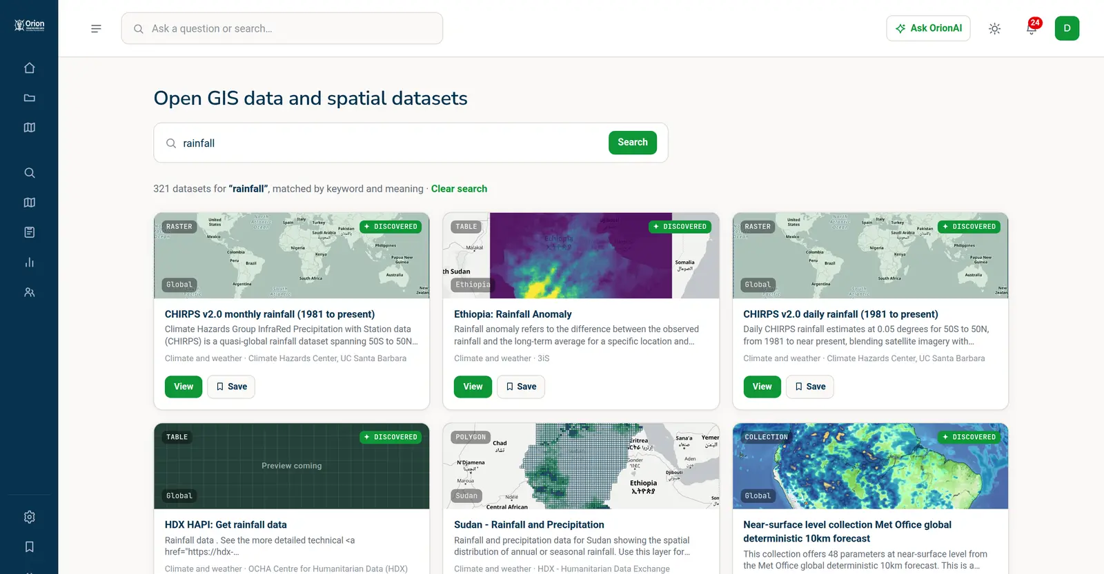
Most GIS starts with a blank map and a search for data. OrionGIS starts with 53,000+ open datasets from national agencies, UN programmes, space agencies and open-data portals: previewed, described, licence-checked and credited, ready to search, download, add to a project or open on a map.
Every theme, every continent
A few of the index’s collections, with live record counts. Open one to browse it.


One request. A finished, explained map.
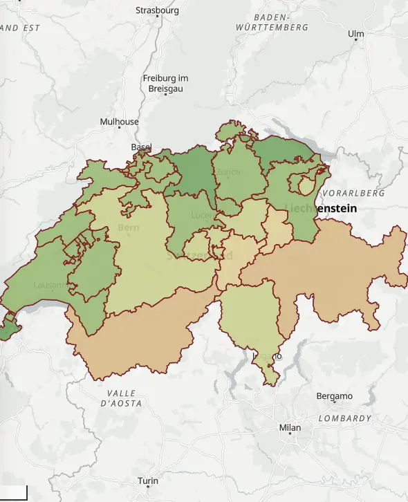
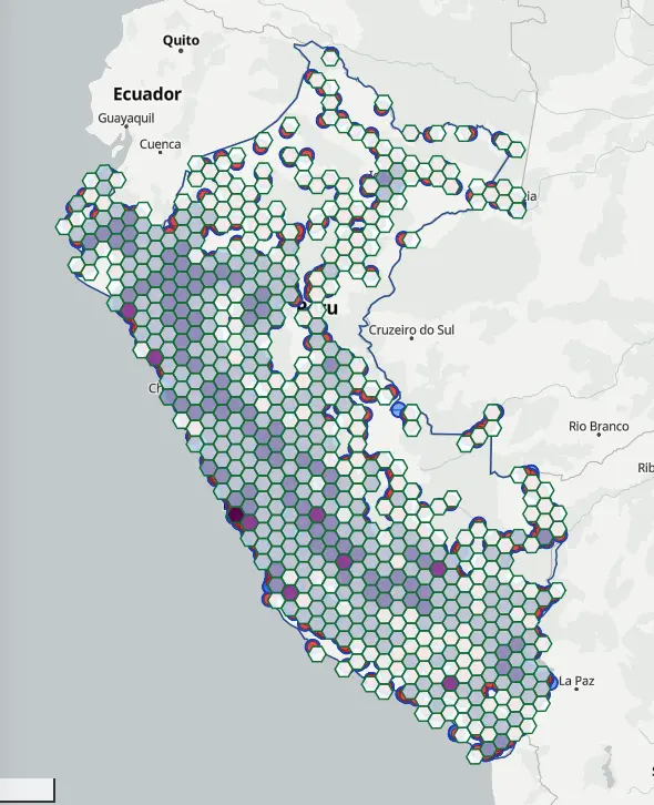
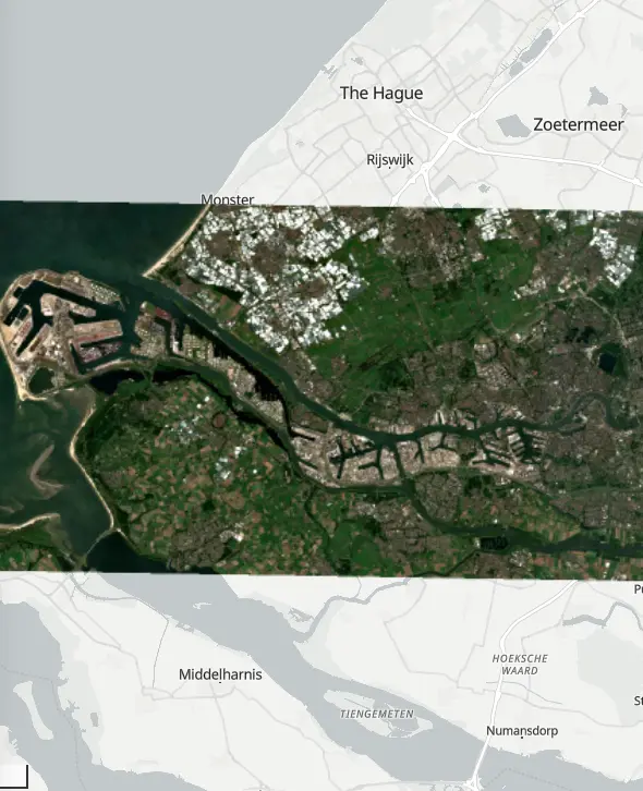
OrionAI is the intelligence layer across OrionGIS. Ask in plain words: it finds the data, runs the analysis, styles the result and tells you what the colours mean, with every source credited. Every map below was made that way, in OrionGIS.
 Po Valley, Italy
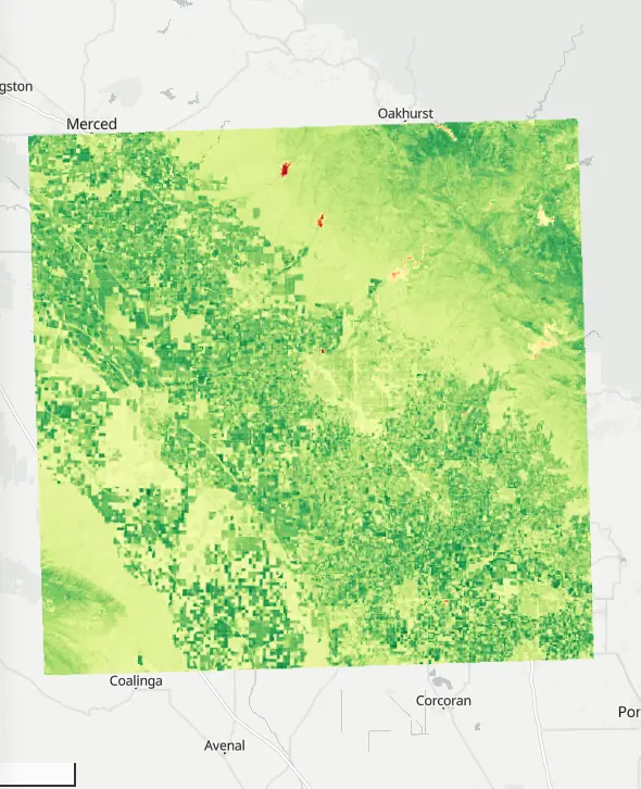
“False colour satellite image of the Po Valley farmland near Mantua, Italy”
 Mt Longonot
“What can be seen from the top of Mount Longonot?”
 Zermatt, Switzerland
“Elevation map of the Alps around Zermatt with hillshade”
 Kampala
“Make a map of schools in Kampala coloured by type”
 Mount Taranaki, New Zealand
“Draw 100 m contour lines for Mount Taranaki in New Zealand”
 Ghana
“Population of each region of Ghana”
 Cusco, Peru
“Trace the stream network around Cusco, Peru”
 Mount Kenya
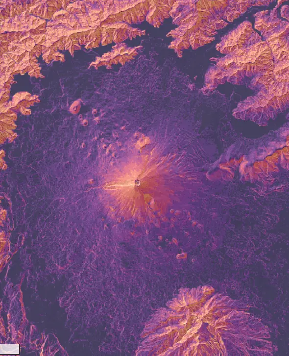
“Show slope and hillshade around Mount Kenya”
Finds the right open data for a question and says where it came from.
Adds the layers, runs the spatial analysis, styles and saves the map.
Drafts a field form from a sentence describing what you need to collect.
Answers questions about a dashboard's data with charts.
The AI is a force multiplier, not a replacement: every step it takes is on the map for a GIS professional to check, change or undo.
From the data that exists to the decisions it informs.
Data, field collection, GIS, AI, analysis, publishing and infrastructure in one workflow, where each part understands the others. No assembly, no integration tax, no exporting between tools.
Find the spatial data that already exists.
Search open datasets from thousands of publishers worldwide alongside your own private uploads. Every record has a preview, a description, its licence and its publisher. Search the index →
Built to work with the GIS you already run.
Every dataset is served through OGC WMS, WFS and WCS and a REST API, so it drops into QGIS, ArcGIS and the rest of your stack. Bring files in, take them out in open formats, and keep your GIS professionals' tools and judgement at the centre.


 MapInfoREST APIs
Direct QGIS plugin · OGC-compliant WMS/WFS/WCS · Compatible with all major GIS software · Export to GeoJSON, Shapefile, GeoPackage, KML

Our free, open-source QGIS plugin: search OrionGIS datasets, add them as live WMS/WFS layers and upload layers to your workspace. Version 0.2.0 · QGIS 3.22+ and QGIS 4.
Geospatial infrastructure your organisation runs.
For teams, enterprises, public agencies, governments and large programmes: one governed platform for your spatial data, field operations, maps, dashboards and services, built on open standards so nothing is locked in.
- ✓ SAML and Google or Microsoft sign-in
- ✓ Unlimited seats and agreed volumes
- ✓ SLA, onboarding and training
- ✓ Your data exportable in open formats, any time
Your organisation's own catalogue of maps and data, branded and searchable.
Published from the same place the data lives, so they stay current.
Every dataset as WMS, WFS and WCS, plus a REST API for your systems.
Start free. Scale when you're ready.
Every plan includes maps, Map Studio, the Global Data Index and private uploads. Plans differ by OrionAI credits, storage, field submissions and seats. Pay by card, or by M-Pesa in Kenya.
For trying it out, and for students
14 days of Team features to start
Start free- Maps, Map Studio, catalogue and private uploads
- 25 OrionAI credits a month
- 3 projects · 500 MB storage
- 250 form submissions a month · 2 forms
- 1 dashboard · 1 published map
For one consultant or researcher
or $150 a year, 2 months free
Get Pro- Everything in Free
- 200 OrionAI credits a month
- Unlimited projects · 5 GB storage
- 2,500 submissions a month · 10 forms
- 3 dashboards · 10 published maps
- Heavy processing · read API access
For a programme or small NGO
or $350 a year, 2 months free
Get Team- Everything in Pro
- 5 seats (+$5 each)
- 1,000 OrionAI credits a month, shared
- 20 GB storage · unlimited forms
- 10,000 submissions a month
- 20 dashboards · 50 published maps · 5 client accounts
For an NGO, firm or department
or $1,000 a year, 2 months free
Get Organisation- Everything in Team
- 20 seats (+$4 each)
- 3,000 OrionAI credits a month, shared
- 50 GB storage · 50,000 submissions a month
- Unlimited dashboards and published maps
- Read + write API · Google and Microsoft sign-in
For enterprises, public agencies, governments and large programmes. Unlimited seats, agreed volumes, SAML sign-on, dedicated or on-premise deployment, SLA and training.
Ask your first question today.
Start with the world's open data and your own, and have your first map in minutes. No credit card required. Or talk to us about a team rollout, an enterprise deployment, or running OrionGIS on your own infrastructure.
Know OrionGIS
What the platform does, what it costs, where your data lives and how to get started.
What is OrionGIS?
OrionGIS is an AI-native cloud GIS platform. One workspace holds a geoportal of open and private spatial data, a web map editor with an AI map maker, offline field data collection, spatial analysis and live dashboards — with AI built into every part and nothing to install.
What is cloud GIS, and what makes OrionGIS AI-native?
Cloud GIS is geographic information system software that runs in a web browser on cloud servers instead of on a desktop. OrionGIS is AI-native: AI was designed into every part of the platform from the start — finding data, making maps, spatial analysis, field forms and dashboards — rather than added later as a chatbot, and every AI result is verified before you act on it.
Where does the GIS data come from?
OrionGIS indexes 25,000+ open GIS datasets from 1,400+ publishers — national statistics and mapping agencies, UN programmes, space agencies and open-data portals — each with a preview, sample rows, licence and the publisher credited. Your own uploads sit in the same search and stay private until you share them.
Can OrionGIS be our geoportal or spatial data infrastructure (SDI)?
Yes. A geoportal is where an organisation publishes its geographic data for people to find, view and download; an SDI adds the metadata, standards, services and governance that let organisations share it reliably. OrionGIS gives an organisation or a government its own geoportal: a governed catalogue with metadata, roles and provenance, every dataset served through OGC WMS, WFS and WCS and a REST API, and maps and dashboards published from the same place — in our cloud, on your servers or both.
Can I make maps with AI?
Yes. Describe the map you need and Orion AI finds the data, builds the layers and styles them in Map Studio, where you refine, print or publish it. Every AI result is verified before it is shown.
Show all 13 questions
Can we run OrionGIS on our own infrastructure?
Yes — three ways. OrionGIS Cloud is fully managed by us (updates, backups, scaling, security). On-premise runs entirely on your own servers for complete data sovereignty — ideal for government and compliance-bound organizations. Hybrid keeps sensitive data local while public-facing maps scale in the cloud.
What does the free plan include?
The full platform — interactive maps, spatial analysis, the open data catalogue and native dataset upload — plus AI answers capped at 10 questions a month. Paid plans add forms, dashboards, and fuller AI limits.
Does the AI replace our GIS team?
No. The AI is a force multiplier: it drafts forms, runs analyses and builds dashboards so specialists stop doing busywork. Every result is verified before it publishes, and your GIS professionals' judgement is the standard it's checked against.
Can I keep using QGIS or ArcGIS?
Yes. Every dataset is exposed as standard OGC WMS/WFS, so it drops straight into any GIS desktop client you already use — plus Orion Connect, our free QGIS plugin, and exports to GeoJSON, Shapefile, GeoPackage and KML.
Do I need to install anything?
No. The catalogue, map viewer, projects, and field-form management all run entirely in your browser. Two optional apps are there if you want them: Orion Collect for filling in forms on Android phones, online or offline, and Orion Connect for working with OrionGIS data inside QGIS.
Where is my data hosted?
On infrastructure you control. OrionGIS runs on your own servers or cloud instance — your data never sits on a third-party platform you don't own.
What happens to data collected in the field?
OrionForms submissions show up inside OrionGIS as soon as they sync, ready to export to CSV or GeoJSON.
Can I get my data out if I ever need to?
Any time. Every dataset can be downloaded in its original format — there's no proprietary lock-in, by design.