← All sectors
OrionGIS for Disaster Response & Emergency Management
Disaster Response & Emergency Management
Map the risk before it becomes a response.
Ask OrionAI
One request. A finished, explained map.
“Map surface water around Tonle Sap lake in Cambodia in 2024”
The map shows surface water around Tonle Sap in 2024, measured from Sentinel-2 imagery at 60 m cells. In the dry season (1 Feb – 15 Mar 2024) water covered 19.7% of the mapped area; by the flood season (1 Sep – 20 Oct 2024) it had grown to 38.1% — roughly double, the lake's classic monsoon expansion.
Data: Copernicus / ESA · geoBoundaries · recorded in OrionGIS, Tonle Sap, Cambodia
How OrionAI works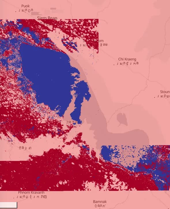 Tonle Sap, Cambodia
What OrionGIS does for disaster response & emergency management
Ready to run on your data now.
- Hazard, exposure and population datasets searchable and layered together today
- Overlay population and roads against hazard layers in one interactive view
- Run rapid field damage assessments with OrionForms — offline from the first hour
- Self-hosted, so response agencies keep control of sensitive operational data
Coming next: Next, we're building automated impact assessments that fuse satellite change detection with field reports.
Working in disaster response & emergency management? Let's talk about what you need mapped.
Other sectors