Find data in the catalogue
How to search the OrionGIS Spatial Data Hub, filter by type and category, read a dataset's page, and add it to a project.
The Spatial Data Hub (choose it in the sidebar) is the catalogue: hundreds of curated datasets — boundaries, population, land cover, climate, transport, health and more — together with the datasets you have uploaded yourself, in one searchable place.
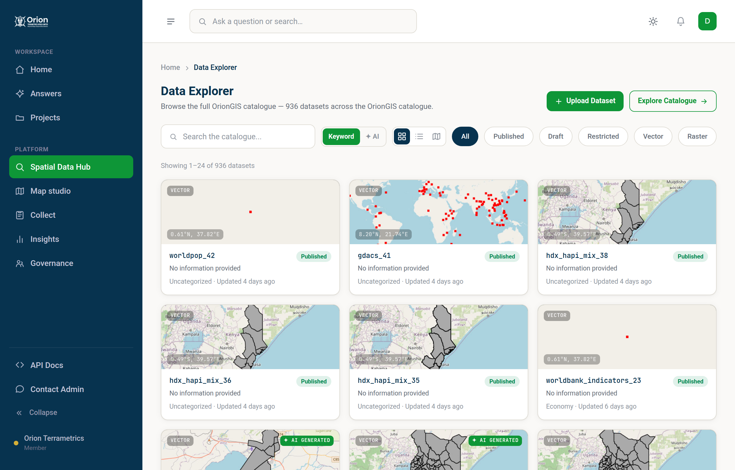
#Search
The search box has two modes, switched with the toggle beside it:
- Keyword — a standard keyword search of the catalogue.
- ✦ AI — describe what you need in plain language ("rainfall over Meru county") and AI finds matching datasets.
Press Enter to see the results.
#Narrow the results
Use the filter chips above the results:
- Type — Vector (points, lines and polygons) or Raster (gridded imagery and surfaces).
- Status — Published, Draft or Restricted. See Access and sharing.
To browse by subject (boundaries, health and so on), choose a category card on Home; a Category chip for it then appears beside these filters.
Click a chip again to remove it. Switch between Grid, List and Map views with the view toggle, or choose Explore Catalogue (Explore Results when filters are on) to open everything on one interactive map. In ✦ AI mode the matches replace the keyword results and the view toggle is hidden.
#Open a dataset
Each dataset has its own page showing:
- a preview of the data on a map;
- its attributes — the columns of the table — with a paged view of the actual rows, and Open full table for the whole thing;
- provenance: where the data comes from, its licence and version. Layers generated by Orion AI say so, and list the source datasets they were derived from;
- actions to Download it (when a file is attached), Add to Project, Save it to your profile and Share its link;
- Web services — copyable OGC URLs for the dataset (see API and web services).
#Add a dataset to a project
Choose Add to Project on a dataset, pick the project (or create a new one), and the dataset appears in that project's Data tab. You can then create a map from it. See Data in a project.
Datasets you upload appear in your own searches next to the curated ones, but only you can see them until you make them public. See Upload your own data.
Something missing or unclear? Tell us — we update the guide as the platform grows.