What is OrionGIS?
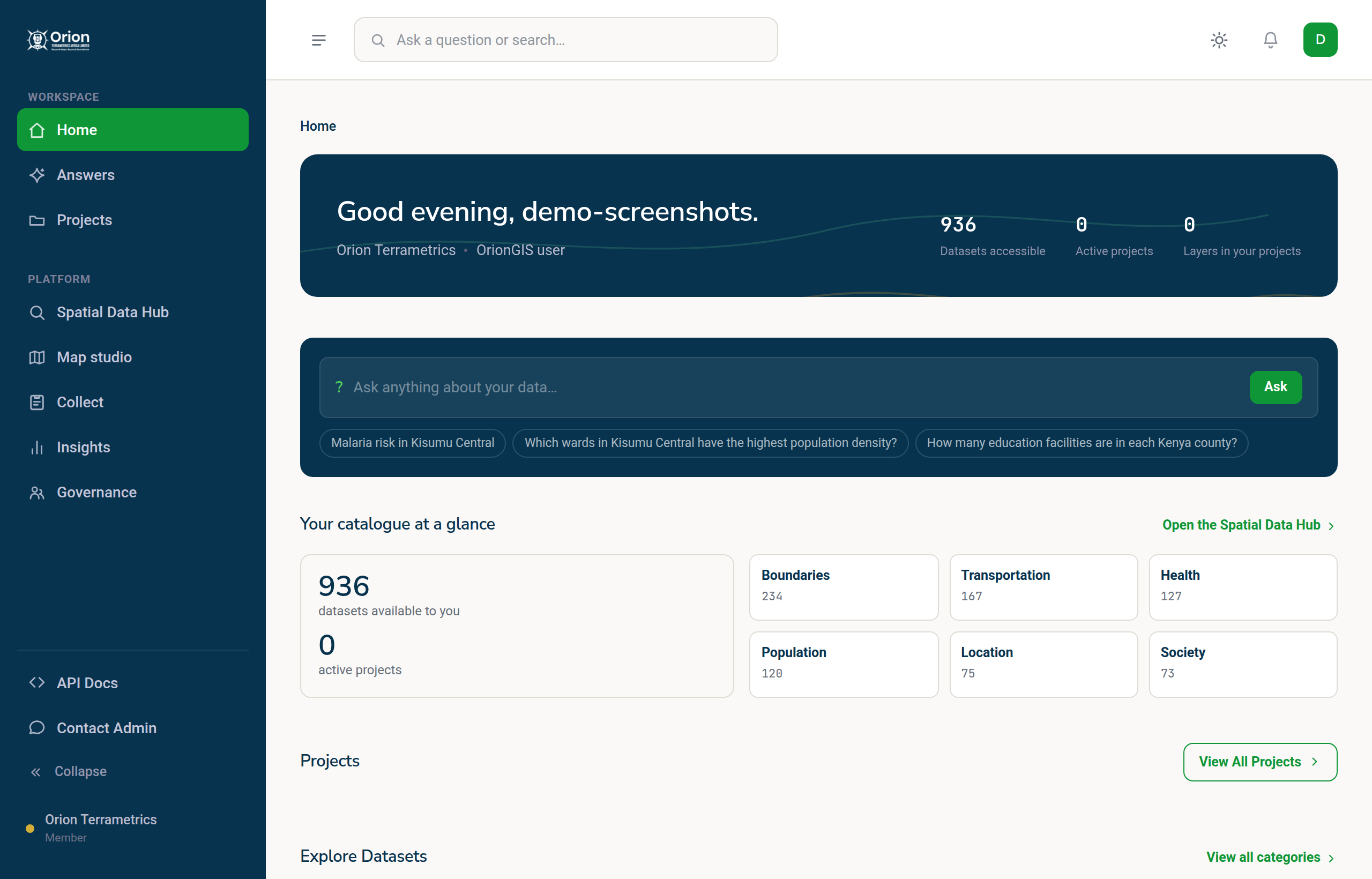
OrionGIS is a browser-based geospatial platform: a searchable data catalogue, a full map editor, field data collection, AI answers and dashboards in one workspace.
OrionGIS is a geospatial platform that runs entirely in your browser. It brings together the tools that normally live in separate products — a data catalogue, a map editor, a field survey app, an analysis assistant and dashboards — so a piece of work can go from raw data to a published map without leaving one workspace, and without installing anything.
It is built by Orion Terrametrics Africa Limited for teams across Africa and beyond: county governments, health and education programmes, utilities, conservation organisations, NGOs and consultancies.
#What you can do with it
- Find data. Search a catalogue of hundreds of curated datasets — boundaries, population, land cover, climate, transport, health — in plain language, alongside your own uploads. See Find data in the catalogue.
- Build maps. Style layers, label and edit features, compose print layouts, and publish a map with a share link, all in Map Studio. See Map Studio basics.
- Collect field data. Design a survey (or describe it and let AI draft it), collect answers offline on a phone, and have submissions sync back as data you can map and analyse. See Create a form.
- Ask questions. Type a spatial question in Answers and Orion AI does the analysis and returns a map. See Ask Orion AI.
- Report. Turn your catalogue and field data into dashboards your stakeholders can filter and present. See Dashboards overview.
- Keep it organised. Everything belongs to a project — one container for a piece of work that holds its maps, data, forms and dashboards. See Core concepts.
#Who it is for
You do not need to be a GIS specialist. Field officers, programme managers and analysts can use it directly, and specialists get real tools — open formats in and out, standard web services for desktop GIS, and an API. Nothing is locked in: you can take your data out in the format you put it in.
#Where to go next
New to OrionGIS? Follow the quickstart to make and share your first map in about ten minutes, or take the tour of the workspace to see where everything lives.
Something missing or unclear? Tell us — we update the guide as the platform grows.